PRIMAR plays a key role in the Baltic Sea e-Nav project by ensuring quality control, testing and distribution of new S-100 products for safer, more efficient, and environmentally friendly navigation. Through collaboration with producers and users of navigation data, PRIMAR contributes to improving navigational data and technology across national borders.
The Baltic Sea e-Nav project is an international initiative aimed at modernizing digital navigation tools in the Baltic Sea region. By implementing the new S-100 standard from the International Hydrographic Organization (IHO), the project aims to enhance safety and efficiency in navigation, as well as promote more environmentally friendly maritime transport in the Baltic Sea.
The method is an effort to produce, test and implement some of the first S-100 products for navigation in the Baltic Sea – aiming for the commercial fleet to be able to utilize fully developed solutions by 2026.

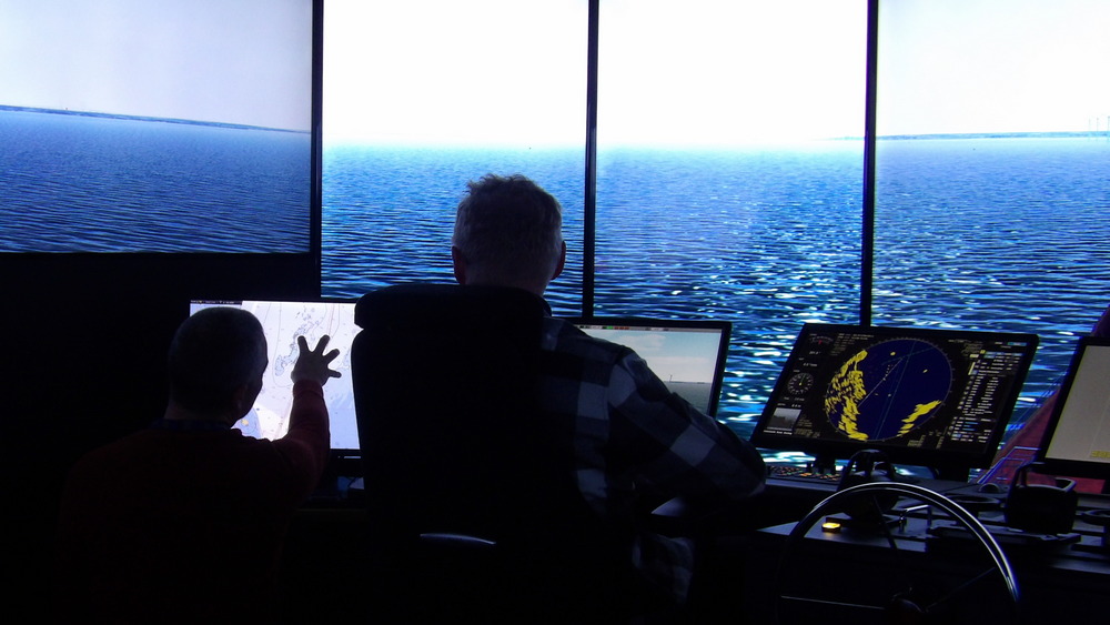
Operatives testing bridge equipment in SAMK’s maritime simulators in Rauma, Finland. (Photo: SAMK)
Common navigation tools
The project involves cooperation between several countries around the Baltic Sea, with the Swedish Maritime Administration serving as coordinator. The main participants are Sweden, Finland, Estonia, Latvia, Germany, and Denmark.
The new S-100 standard requires that all actors uniformly apply and implement the standard and its product specifications, making it an effective tool for coordinating navigation and planning in the region. Guidelines to ensure harmonization of products and services across national borders have been developed under the auspices of the Baltic Sea Hydrographic Commission (BSHC) to facilitate this process.
The Baltic Sea e-Nav project focuses on developing the following products:
- S-101: Next-generation Electronic Navigational Charts (ENCs) providing full coverage of major shipping routes in the Baltic Sea.
- S-102: Seabed information covering relevant shipping routes, fairways, and port approaches where sufficiently high-quality data is available.
- S-104/S-111: Water level (tide) and surface current information.
Access to real-time data on depth conditions, water levels, and currents provides opportunities for simplified and faster route planning. Digitally available more detailed and dynamic chart data for ECDIS contributes to improved navigational safety.
The expected benefits include safer operations and enhanced environmental efficiency by optimizing sailing routes and reducing fuel consumption.
Would you like to learn more about S-102? Download our quick guide
PRIMAR’s Role in the Baltic Sea e-Nav Project
PRIMAR plays a central role in the project as an associated partner responsible for the new S-100 standard’s knowledge sharing, supporting production, quality control, testing and distribution of S-100-based products.
A key task is to establish a common test database called the ”PRIMAR Baltic Sea Project Services”. This functions as a clone of the live database normally used for collecting, controlling, validating and distributing data from chart producers to the ECDIS end users, but enhanced with the latest developments - now supporting more S-100 products and ENC Dual Fuel options.
To ensure the quality of such data from hydrographic offices and meteorological/hydrological organizations in Sweden, Finland, Germany, Estonia, Latvia, and Denmark, PRIMAR employs a process for its member states, where producers upload data through a PRIMAR VPN system.
Next, the data undergoes quality control before being loaded into a prototype S-100 ECDIS from OSI Maritime Systems. Since this standard and its first phase product specifications for ECDIS have just very recently been published, PRIMAR has developed several internal tools for testing, validation, control and distribution.
These include an upload check to prevent incomplete datasets or datasets with errors from entering the database, as well as manual reviews where experts assess quality and functionality.
Also read: S-102 Depth Data Benefits
Cooperating with all of the maritime industry
Throughout the project period, PRIMAR ensures continuous feedback to producers, enabling them to adjust their processes and improve data quality. It is an essential collaboration, fostering mutual learning throughout the process.
Equally important in this role as a technical operator, PRIMAR facilitates opportunities for producers, developers and OEMs to test products such as S-101, S-102, S-104, and S-111 in their own systems. Participants in the project include the Research Institutes of Sweden (RISE), the Finnish ECDIS manufacturer Furuno, and Satakunta University of Applied Sciences (SAMK), also from Finland.
This collaboration is essential for developing and optimizing the new products. PRIMAR acts as a bridge firstly between different data producers themselves nationally and internationally and secondly between the data producers and commercial actors, providing valuable insights into how the data functions in practice and what needs improvement.
Catch up: How S-102 Bathymetric Data is Produced
Ready-made S-100 products in 2025
One of the key objectives at the conclusion of the project is to integrate the data produced into PRIMAR’s live operational database and make it accessible to the commercial market.
Through the Baltic Sea e-Nav project, PRIMAR aims to demonstrate its ability to lead the development of new maritime data standards while fostering effective collaboration with both public and private stakeholders across the Baltic Sea region.
S-100 datasets are already commercially available. In September 2025, Estonia’s Hydrographic Service, under the Estonian Transport Administration, released datasets for S-102, S-104 and S-111. Following ECC’s regular quality assurance process, these datasets are now available via the PRIMAR database. Notably, S-104 and S-111 products are updated automatically every 24 hours.
These early achievements have been well received by the project community.

Coverage of S-111 surface current information of the Estonian coast.
More details on the project site
The Baltic Sea e-Nav ProjectOverview:
Data Producers:
Research Institutes responsible for testing and improving the products:
Navigation Technology:
ENC Distribution:
|